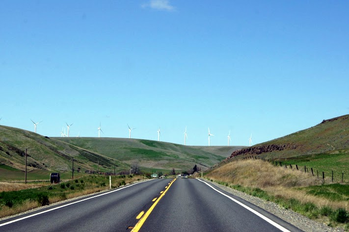
 After spending most of yesterday on Highway 12 in Idaho, today is the same highway in Washington, still scenic. [alpine-phototile-for-picasa-and-google-plus src=”user_album” uid=”117292386093793315084″ ualb=”5869848744875473825″ imgl=”fancybox” dltext=”Picasa” style=”floor” row=”4″ num=”150″ size=”220″ border=”1″ highlight=”1″ align=”center”...
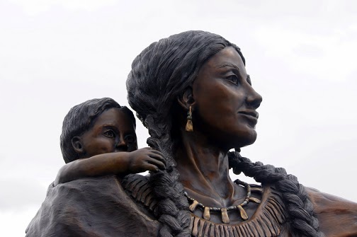
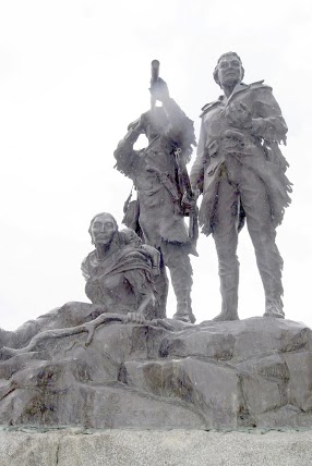
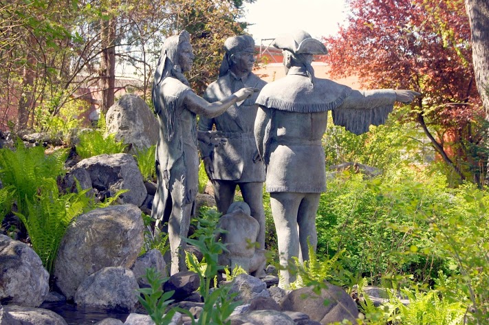 The statutes in their outdoor mall are outstanding. Probably the best Sacajawea that I have seen. N46.41265 W117.02633 Elevation 859 feet [alpine-phototile-for-picasa-and-google-plus src=”user_album” uid=”117292386093793315084″ ualb=”5869845622437523745″ imgl=”fancybox” dltext=”Picasa” style=”floor” row=”4″ num=”150″ size=”220″ border=”1″ highlight=”1″ align=”center”...
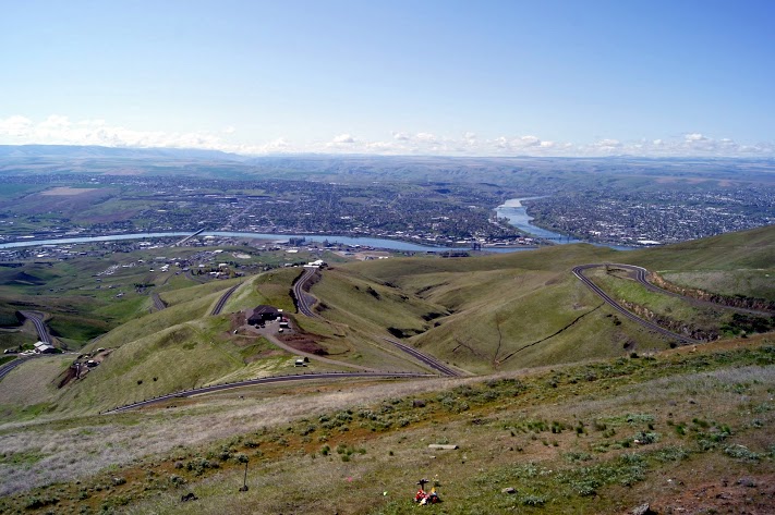 From this vantage point, you can see Idaho, Washington and Oregon. N46.46041 W117.01647 Elevation 2598 feet [alpine-phototile-for-picasa-and-google-plus src=”user_album” uid=”117292386093793315084″ ualb=”5869844869455354017″ imgl=”fancybox” dltext=”Picasa” style=”floor” row=”4″ num=”150″ size=”220″ border=”1″ highlight=”1″ align=”center”...
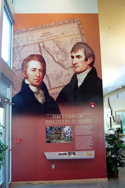 Separated only by the Snake River, tourists and residents alike travel back and forth quite often. [alpine-phototile-for-picasa-and-google-plus src=”user_album” uid=”117292386093793315084″ ualb=”5869843879291425841″ imgl=”fancybox” dltext=”Picasa” style=”floor” row=”4″ num=”150″ size=”220″ border=”1″ highlight=”1″ align=”center”...
 Highway 12 in Idaho is possibly the most scenic drive I have ever taken. The range of altitudes, weather, scenery, and history, all make this an unforgettable day of driving. It was much more than I expected today, it was remarkable. There were times when I was nervous about the visibility and driving conditions, but even then I was stunned by the beauty. Lewis and Clark faced these same conditions and the comments in their journals reflected the same awe that I felt today. At the Lolo Summit, I wanted to walk some of the same trails that the Corps traveled, the peaks of the Bitterroot Mountains. The Ranger there said I was welcome to do that, but she warned me that the snow varied from 5 feet to 7 feet on those trails. She also advised that the snow will probably remain on those trails well into June. Needless to say, I didn’t take that hike. Highway 12 follows the rivers from the summit to the valley below and there is new beauty at every turn. I can only imagine this drive in a convertible in warm weather or maybe a Harley. The altitude at Lolo summit was 5,366 feet. Daily data: Beginning odometer at Super 8 in Missoula, Montana was 29,794 miles. Ending odometer at Comfort Inn at Lewiston, Idaho is 30,019 miles. Fuel stop at Missoula. 10.368 gallons @ $3.259 for a total of $33.79. Meals for the day were $24.00 Lodging for tonight is $79.74. [alpine-phototile-for-picasa-and-google-plus src=”user_album” uid=”117292386093793315084″ ualb=”5869457400327670465″ imgl=”fancybox” dltext=”Picasa” style=”floor” row=”4″ num=”150″ size=”220″ border=”1″ highlight=”1″ align=”center”...
 The Chief said “I have never met men without blankets…” Extremes in altitude and temperature today, in a 200 mile drive. The highest point for the day was Big Hole Pass at 7,400 feet. Other significant altitudes were: Badger Pass at 6,694 feet, and Grasshopper Creek at 6,714 feet. Chief Joseph Pass at 7,265 feet is the one with all the snow, even the path to the outhouse is drifted. No, that’s not me fishing. I only wish that it was. Daily data: Beginning odometer at Best Western in Dillon, Montana was 29,586. Ending mileage at Super 8 at Missoula, Montana was 29,789 miles. Meals for the day cost $22.00. Lodging for the night is $60.55. [alpine-phototile-for-picasa-and-google-plus src=”user_album” uid=”117292386093793315084″ ualb=”5869077870147628225″ imgl=”fancybox” dltext=”Picasa” style=”floor” row=”4″ num=”150″ size=”220″ border=”1″ highlight=”1″ align=”center”...
 Day 19 of my journey tours a good portion of Western Montana. Includes a few odds and ends visited along the day’s travels. The photos will also show that to follow as near as possible along the Missouri River, there are some pretty narrow, winding dirt roads. Daily data: Beginning odometer at Super 8 in Helena, Montana was 29,405 miles. Ending odometer at Best Western in Dillon, Montana is 29,582 miles Meals for the day were $22.00 Fuel bought at Helena, 10.654 gallons @ $3.269 for a total of $34.83 + April 19, 2013 [alpine-phototile-for-picasa-and-google-plus src=”user_album” uid=”117292386093793315084″ ualb=”5868714806476065073″ imgl=”fancybox” dltext=”Picasa” style=”floor” row=”4″ num=”150″ size=”220″ border=”1″ highlight=”1″ align=”center”...
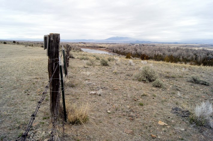
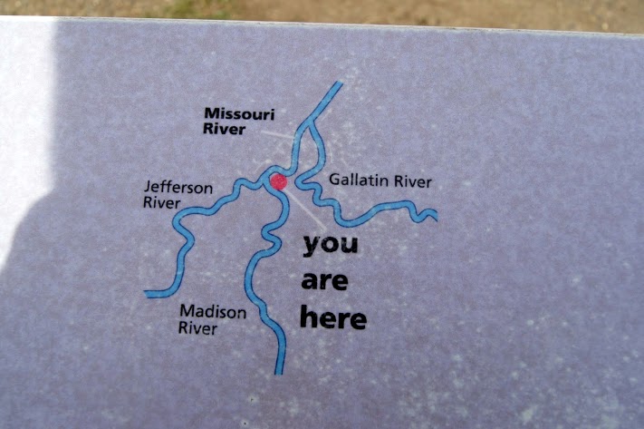 The confluence of the Jefferson River, the Madison River, and the Gallatin River all combine to create the Missouri River. CaptainLewis described the scene pretty well when he wrote “the country opens suddenly to extensive and beautiful plains and meadows which appear to be surrounded in every direction with distant and lofty mountains.” This is also the location of Sacagawea’s capture and where she returned years later with Lewis and Clark. Additional information can be found at http://stateparks.mt.gov/missouri-headwaters/ N45.92616 W111.50306 Elevation 4663 feet [alpine-phototile-for-picasa-and-google-plus src=”user_album” uid=”117292386093793315084″ ualb=”5868721127277867505″ imgl=”fancybox” dltext=”Picasa” style=”floor” row=”4″ num=”150″ size=”220″ border=”1″ highlight=”1″ align=”center”...
 A small, remote Montana town that honors Sacagawea, Pompey, and Seaman. Small town park with a beautiful statute that includes Sacagawea, Pompey, and Seaman. The park also includes a 1/2 scale dugout canoe like the ones being used by the Corps. N45.54362 W112.33362 Elevation 3923 feet [alpine-phototile-for-picasa-and-google-plus src=”user_album” uid=”117292386093793315084″ ualb=”5868724264325057313″ imgl=”fancybox” dltext=”Picasa” style=”floor” row=”4″ num=”150″ size=”220″ border=”1″ highlight=”1″ align=”center”...
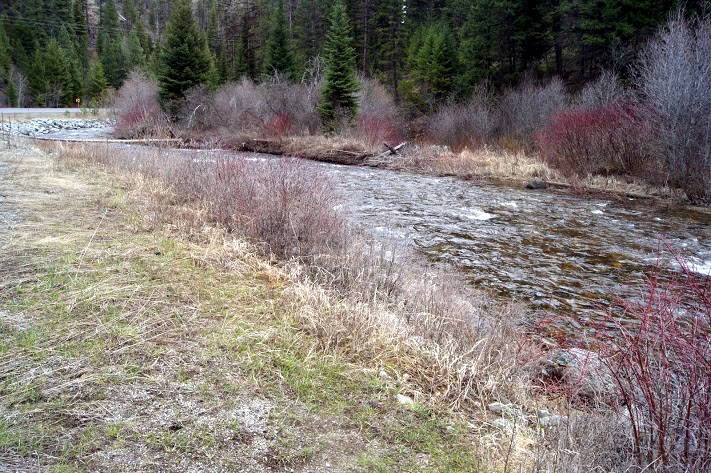
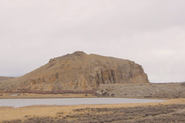 Sacagawea recognized the landmark and knew she was home. A significant landmark on the Missouri River was a signal that the Corps was nearing the home tribe of Sacagawea and the promise of horses for the rest of the journey. For really great detail and drama concerning Beaverhead Rock, check out the site http://www.nps.gov/nr/travel/lewisandclark/bea.htm N45.38620 W112.45306 elevation 4845 feet [alpine-phototile-for-picasa-and-google-plus src=”user_album” uid=”117292386093793315084″ ualb=”5868725092489525505″ imgl=”fancybox” dltext=”Picasa” style=”floor” row=”4″ num=”150″ size=”220″ border=”1″ highlight=”1″ align=”center”...
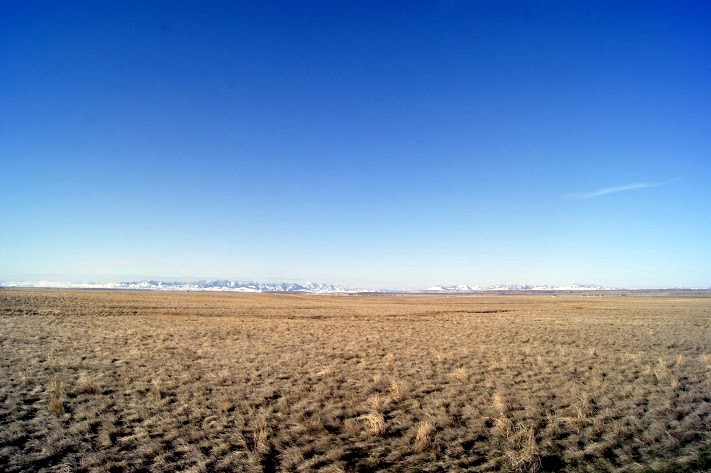
 After I entered the journal entries for yesterday, I had one more pretty cool adventure. As I was getting ready for bed about 10pm, I noticed that I was witnessing the very first clear sky of my trip. I just couldn’t resist an opportunity to see the sky better than I have ever seen it, on a totally clear, dark night with no ambient light in Montana. I dressed warm and headed out in my truck to get away from the lights of Great Falls. I finally found a “turn out” about 45 miles North of Great Falls and when I pulled in and shut off my lights, it was like being in a cave. There was absolutely no lights visible except the partial moon and a billion stars. Even the Milky Way welcomed me to the Big Sky country. It was truly an amazing sight. If you have never seen a totally dark sky, put that on your list. As my eyes adjusted to the darkness even better, I could see even more stars, probably about a billion and a half by now. It reminded me of the way the sky used to look when I was a young Boy Scout camping in the wilderness. Part of our routine was to lie flat on our backs and just gaze at the stars. OK, now about today. The mountains are beginning to be a more prominent feature in the days drive. I wonder how Lewis and Clark felt as they reached this point in their journey. They have to be accepting that these mountains are not like they ones they know about in Virginia and Tennessee. These were real mountains. ...
 Buffalo jump? Who wouldn’t want to see that? Wow, now I understand what a buffalo jump is and it is not something I want to think about too much. This location is believed to be one of the main jump sites for several different tribes of natives over a few hundred years. Odometer reading 29,311 N47.48809 W111.53249 Elevation 3834 feet [alpine-phototile-for-picasa-and-google-plus src=”user_album” uid=”117292386093793315084″ ualb=”5868323792095101361″ imgl=”fancybox” dltext=”Picasa” style=”floor” row=”4″ num=”150″ size=”220″ border=”1″ highlight=”1″ align=”center”...
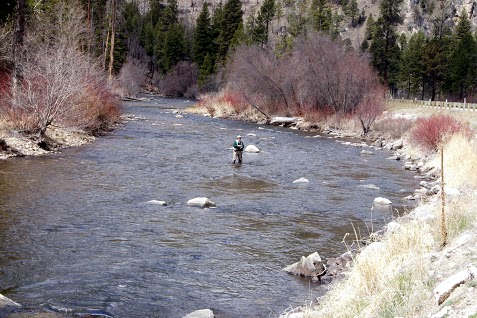
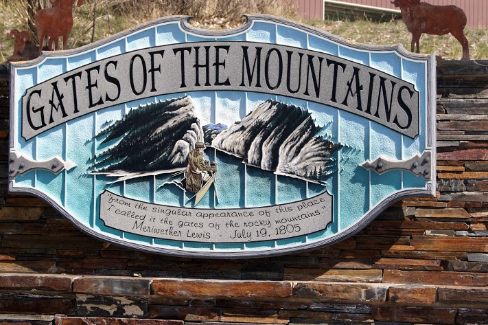 A beautiful lake nestled in the mountains and getting ready for spring tourist season. Since the season doesn’t actually start until May 1, the tour boats were not operational and no one was interested in assisting a wandering tourist like me. The lake is beautiful but the Lewis and Clark connection is the part called the “Gates” which is not visible except by boat. While visiting with a man that was launching his fishing boat, I casually asked if I could hire him to take me to the Gates. His reply was something like “the trout are really biting and you don’t have enough money for me to waste my time taking you for a boat ride”. Well, OK then, a good day to you too. I guess I really couldn’t blame him. I saw a few trout at the boat dock and they looked to be 16 to 20 inches long. odometer 29,382 N46.83177 W111.95298 Elevation 3612 [alpine-phototile-for-picasa-and-google-plus src=”user_album” uid=”117292386093793315084″ ualb=”5868330355014851425″ imgl=”fancybox” dltext=”Picasa” style=”floor” row=”4″ num=”150″ size=”220″ border=”1″ highlight=”1″ align=”center”...
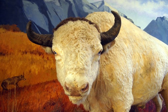 I took photos today in the House of Representatives in the Montana State Capitol Building. How cool is that? I visited the capitol building to see a very famous 25 foot mural related to Lewis and Clark. The mural is on the front wall of the Chambers for the House of Representatives and they were in session. When I explained my mission, I was allowed to enter the gallery and photograph the mural– NO FLASH and try not to disturb the session. I did exactly that. They had some kind of school drum team performing for them, how could a couple of photos disturb that? The Montana State Museum across the street from the capitol had numerous remarkable displays for only a $5 admission fee. I was not sure I wanted to pay until the young lady mentioned a “white buffalo”. I had to see that. Again, NO FLASH photography. The white buffalo is named “Big Medicine” in recognition of his symbolic importance to Native Americans. It is a beautiful specimen. odometer reading 29,404 N46.58680 W112.01602 Elevation 4149 feet [alpine-phototile-for-picasa-and-google-plus src=”user_album” uid=”117292386093793315084″ ualb=”5868333885523999073″ imgl=”fancybox” dltext=”Picasa” style=”floor” row=”4″ num=”150″ size=”220″ border=”1″ highlight=”1″ align=”center”...
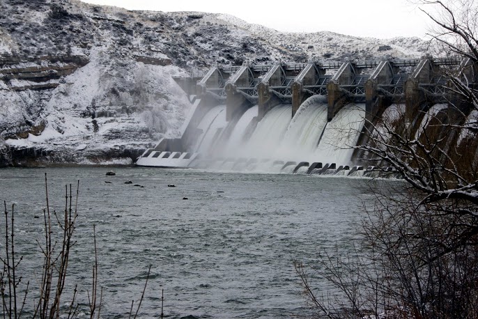 Lewis and Clark had been warned but they really didn’t know how bad it would be. Based on information provided by the tribes on the river, Lewis and Clark were anticipating the barrier of the falls. They knew they would have to portage and they were expecting that to add an extra day of hard work to get past the falls and back on the river. The falls were much greater than they expected and it ended up taking them an extra month to get around them. As you can see in the photos, the land surrounding the falls was not conducive to hauling the boats and all the cargo. The portage was described in the journals as being very tough, with steep hills, cactus tearing the mens moccasins, and the heat was unbearable—but the men did not complain. [alpine-phototile-for-picasa-and-google-plus src=”user_album” uid=”117292386093793315084″ ualb=”5867937521510664977″ imgl=”fancybox” dltext=”Picasa” style=”floor” row=”4″ num=”150″ size=”220″ border=”1″ highlight=”1″ align=”center”...
 This little Montana town is a very interesting, intriguing place out in the middle of nowhere. Known as the birthplace of Montana. So many interesting stories in this town and they have taken the trouble to share the stories with the wandering tourist. A drowned governor, Old Shep, the Grand Hotel, The bloodiest block in the West. Just some of the stories. For details about Old Shep, see http://www.fortbenton.com/shep/story.html. The town of Fort Benton has its own website also http://www.fortbenton.com/. N47.81676 W110.66817 Elevation 2637 feet [alpine-phototile-for-picasa-and-google-plus src=”user_album” uid=”117292386093793315084″ ualb=”5867943399162575089″ imgl=”fancybox” dltext=”Picasa” style=”floor” row=”4″ num=”150″ size=”220″ border=”1″ highlight=”1″ align=”center”...