 He followed in the footsteps of Lewis and Clark. Tuesday, Noel Oliver stopped by KHQA to share his experiences with KHQA’s Brooke...
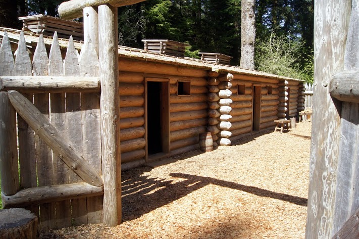 A fort, hastily built to survive the cold, wet winter of the Columbia River and the Pacific Ocean. Arriving in mid-November, the fort had to be built quickly to assist in their survival for the winter. The fort is much smaller than I expected, but it obviously fit their needs. N46.13397 W123.88036 [alpine-phototile-for-picasa-and-google-plus src=”user_album” uid=”117292386093793315084″ ualb=”5871344913245914625″ imgl=”fancybox” dltext=”Picasa” style=”floor” row=”4″ num=”150″ size=”220″ border=”1″ highlight=”1″ align=”center”...
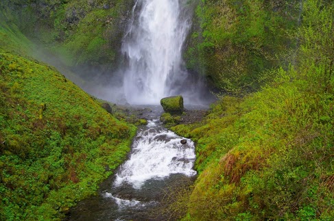 Surprisingly beautiful waterfalls Reminds me of some I saw in Hawaii. The walls of the gorge are steep and rocky with very thick greenery so it should not be a surprise that springs and snow melt would produce some pretty grand waterfalls. Horsetail Falls N45.59049 W122.06858 Multomah Falls N45.57842 W122.11894 [alpine-phototile-for-picasa-and-google-plus src=”user_album” uid=”117292386093793315084″ ualb=”5870941514422922305″ imgl=”fancybox” dltext=”Picasa” style=”floor” row=”4″ num=”150″ size=”220″ border=”1″ highlight=”1″ align=”center”...
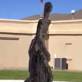 Here is a video of the disappearing statue.
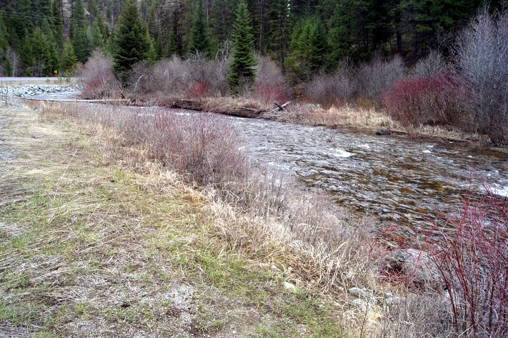 Highway 12 in Idaho is possibly the most scenic drive I have ever taken. The range of altitudes, weather, scenery, and history, all make this an unforgettable day of driving. It was much more than I expected today, it was remarkable. There were times when I was nervous about the visibility and driving conditions, but even then I was stunned by the beauty. Lewis and Clark faced these same conditions and the comments in their journals reflected the same awe that I felt today. At the Lolo Summit, I wanted to walk some of the same trails that the Corps traveled, the peaks of the Bitterroot Mountains. The Ranger there said I was welcome to do that, but she warned me that the snow varied from 5 feet to 7 feet on those trails. She also advised that the snow will probably remain on those trails well into June. Needless to say, I didn’t take that hike. Highway 12 follows the rivers from the summit to the valley below and there is new beauty at every turn. I can only imagine this drive in a convertible in warm weather or maybe a Harley. The altitude at Lolo summit was 5,366 feet. Daily data: Beginning odometer at Super 8 in Missoula, Montana was 29,794 miles. Ending odometer at Comfort Inn at Lewiston, Idaho is 30,019 miles. Fuel stop at Missoula. 10.368 gallons @ $3.259 for a total of $33.79. Meals for the day were $24.00 Lodging for tonight is $79.74. [alpine-phototile-for-picasa-and-google-plus src=”user_album” uid=”117292386093793315084″ ualb=”5869457400327670465″ imgl=”fancybox” dltext=”Picasa” style=”floor” row=”4″ num=”150″ size=”220″ border=”1″ highlight=”1″ align=”center”...
 A Colchester man is preparing for a 4,500 mile journey north, following in the footsteps of two of America’s most famous pioneers. by Brooke Hasch Click here to read the full article. ...
 WGEM 105 News/Talk Radio interview discussing the trip....
 This video consists of a few photographs of the departure area that I took this last summer. Music from the CD Aural Traditions by Chris Vallillo Gin Ridge Music,...