 The third day into my journey and I am very quickly learning that I need to slow down a bit. Most of my entire life has been pretty scheduled and organized and I am most comfortable under those circumstances. I am learning that this trip is not going to be all that organized and scheduled. I really have to make myself slow down, let the circumstances dictate the pace, stay a little longer if more time is needed, and don’t feel the need to rush off to the next mark on my map. Today is a good example of that. I just could not leave Lexington as I had planned. It deserved more time, more walking around, more study, and more investment than I had planned. Maybe over the next few weeks, I will come across some places that will go fairly quickly and I can make up the time; but I’m not sure about that. I am sure that I will not hurry and I will absorb all that I can, and I will enjoy each step. This has been a life-long desire of mine, so why hurry. Data for the day: Beginning odometer at Richmond, Mo 26,559 Ending odometer at Independence, Mo 26,635 Drury Inn, Independence, MO N39.05326 W94.47480 899 ft 50 degrees F. Lodging costs $102.00 (includes evening meal and breakfast tomorrow) Lunch $8.00 Entry fee at Fort Osage $3.00 + April 03,...
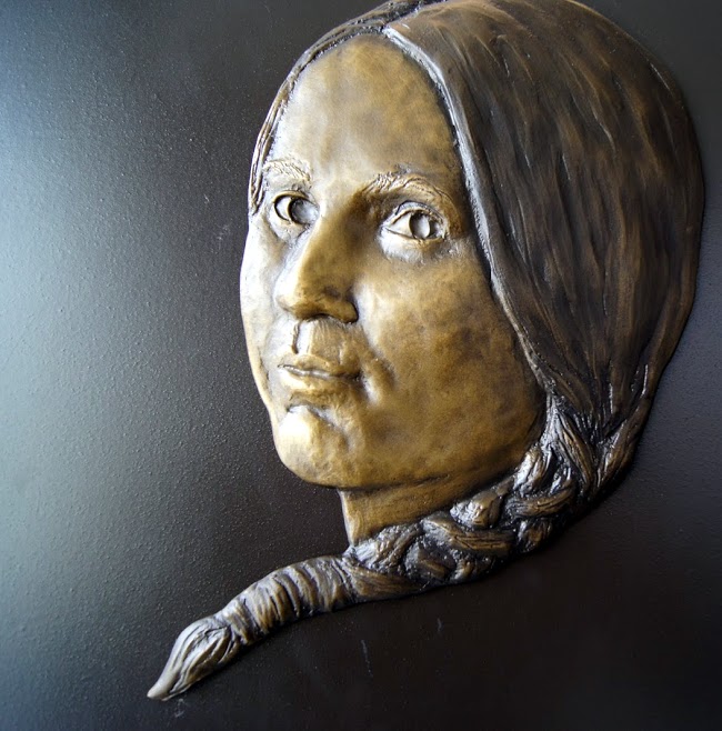
 More history than I could absorb in a day. This is a place that I will have to revisit some day when I can be better prepared to understand the complexities of the 19th century in this part of Missouri. Who knew that there was a “Battle of Lexington” in the Civil War? I always thought the Battle of Lexington was a revolutionary war battle. Well, it was that too, but this one is in Missouri and involves “HEMP”. Not the marijuana type that we know of today. The confederates used the river soaked hemp bales to protect them as they advanced on the union soldiers on the third day of battle in Lexington. This strategy forced the union soldiers to surrender and forfeit the territory. Additional stories of Lexington in the 1800’s are too numerous and involved for me to begin to discuss here. If you are interested, do some research about Lexington, Missouri. N39.18553 W93.88286 872 ft [alpine-phototile-for-picasa-and-google-plus src=”user_album” uid=”117292386093793315084″ ualb=”5862761675920024449″ imgl=”fancybox” dltext=”Picasa” style=”floor” row=”4″ num=”75″ size=”220″ border=”1″ highlight=”1″ align=”center”...
 I saw a sign on the highway that indicated a “Lewis and Clark historic place”, so I turned off the main path. After driving about 4 miles and wondering if I missed other signs, I finally came to a small Missouri River town of Napolean. On the riverbank there was a small marker indicating that Lewis and Clark had camped there on their westward journey. N39.13217 W94.06961 760 ft [alpine-phototile-for-picasa-and-google-plus src=”user_album” uid=”117292386093793315084″ ualb=”5862768871657761873″ imgl=”fancybox” dltext=”Picasa” style=”floor” row=”4″ num=”50″ size=”220″ border=”1″ highlight=”1″ align=”center”...
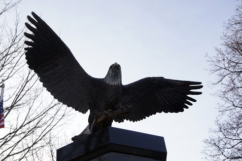
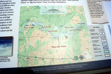
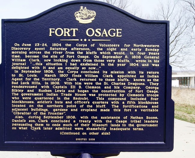 After the epic journey, Captain Clark continues to serve his President. Under the direction of William Clark and Captain Eli B. Clemson, soldiers erected Fort Osage in 1808 to serve as an outpost for the newly established Louisiana Purchase. It housed soldiers assigned to guard the new territory. The fort also offered Missouri’s early settlers and explorers a sanctuary from which to venture westward. N39.18594 W94.19367 899 ft [alpine-phototile-for-picasa-and-google-plus src=”user_album” uid=”117292386093793315084″ ualb=”5862769806129572481″ imgl=”fancybox” dltext=”Picasa” style=”floor” row=”4″ num=”50″ size=”220″ border=”1″ highlight=”1″ align=”center”...