 Day 19 of my journey tours a good portion of Western Montana. Includes a few odds and ends visited along the day’s travels. The photos will also show that to follow as near as possible along the Missouri River, there are some pretty narrow, winding dirt roads. Daily data: Beginning odometer at Super 8 in Helena, Montana was 29,405 miles. Ending odometer at Best Western in Dillon, Montana is 29,582 miles Meals for the day were $22.00 Fuel bought at Helena, 10.654 gallons @ $3.269 for a total of $34.83 + April 19, 2013 [alpine-phototile-for-picasa-and-google-plus src=”user_album” uid=”117292386093793315084″ ualb=”5868714806476065073″ imgl=”fancybox” dltext=”Picasa” style=”floor” row=”4″ num=”150″ size=”220″ border=”1″ highlight=”1″ align=”center”...
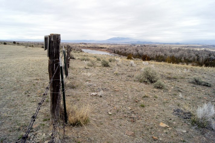
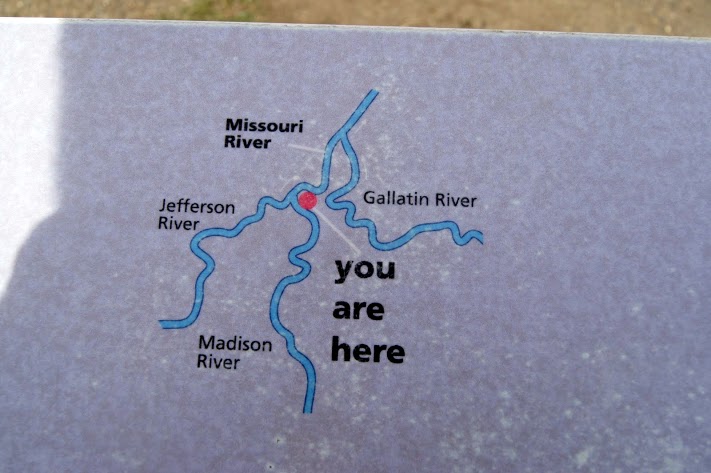 The confluence of the Jefferson River, the Madison River, and the Gallatin River all combine to create the Missouri River. CaptainLewis described the scene pretty well when he wrote “the country opens suddenly to extensive and beautiful plains and meadows which appear to be surrounded in every direction with distant and lofty mountains.” This is also the location of Sacagawea’s capture and where she returned years later with Lewis and Clark. Additional information can be found at http://stateparks.mt.gov/missouri-headwaters/ N45.92616 W111.50306 Elevation 4663 feet [alpine-phototile-for-picasa-and-google-plus src=”user_album” uid=”117292386093793315084″ ualb=”5868721127277867505″ imgl=”fancybox” dltext=”Picasa” style=”floor” row=”4″ num=”150″ size=”220″ border=”1″ highlight=”1″ align=”center”...
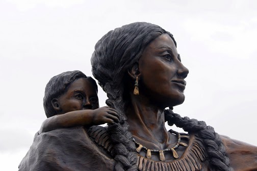 A small, remote Montana town that honors Sacagawea, Pompey, and Seaman. Small town park with a beautiful statute that includes Sacagawea, Pompey, and Seaman. The park also includes a 1/2 scale dugout canoe like the ones being used by the Corps. N45.54362 W112.33362 Elevation 3923 feet [alpine-phototile-for-picasa-and-google-plus src=”user_album” uid=”117292386093793315084″ ualb=”5868724264325057313″ imgl=”fancybox” dltext=”Picasa” style=”floor” row=”4″ num=”150″ size=”220″ border=”1″ highlight=”1″ align=”center”...
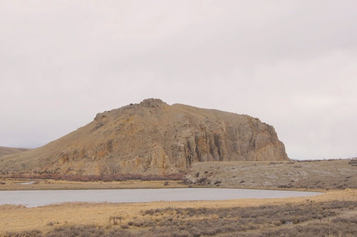 Sacagawea recognized the landmark and knew she was home. A significant landmark on the Missouri River was a signal that the Corps was nearing the home tribe of Sacagawea and the promise of horses for the rest of the journey. For really great detail and drama concerning Beaverhead Rock, check out the site http://www.nps.gov/nr/travel/lewisandclark/bea.htm N45.38620 W112.45306 elevation 4845 feet [alpine-phototile-for-picasa-and-google-plus src=”user_album” uid=”117292386093793315084″ ualb=”5868725092489525505″ imgl=”fancybox” dltext=”Picasa” style=”floor” row=”4″ num=”150″ size=”220″ border=”1″ highlight=”1″ align=”center”...