 Just imagine Captain Clark standing on top of this hill and looking around, seeing both the Missouri and the Osage Rivers.
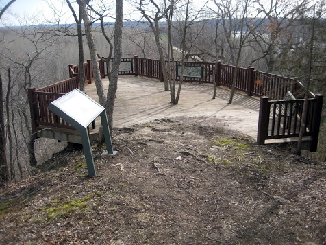
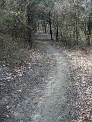 Today was a little different than yesterday. I was only able to visit two sites today because both of them involved some rather long hikes and then a considerable drive between them. The first site is Clark’s Hill. This is a location noted in Captain Clark’s journal. Captain Clark notes that on June 2, 1804, he climbed the hill at this point to observe the confluence of the Osage River and the Missouri River and the surrounding countryside. From what I could see today, he climbed a nearly vertical hill for about 200 feet. My climb today was not that steep, but it was almost a mile and it was up and down hill on a marked path. It was a comfortably cool day and there was no one else within miles. The beauty of the scenery and the sounds of nature combined to keep a smile on my face the whole time I was there. The second site is Arrow Rock State Park. A very beautiful state park with very nice roads and pathways and streams. I am not aware that it is historically significant to the Lewis and Clark era, but it does have a preserved pioneer village that would be worth a visit at some point in the future. Yesterday, I mentioned an artist named Gary Lucy but I forgot to include his web site. It is garylucy.com Be sure to check the section called “prints”. They are amazing. Data for the Day: Bought fuel at Columbia, MO. 11.493 gal @ $3.539 for a total of $40.67. N38.96633 W92.33288 735 feet 42 degrees F. Food costs for the day are...
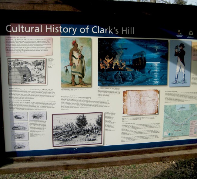 A very beautiful hike along a marked trail leads to a rewarding view of the confluence of the Osage River and the Missouri River and the surrounding countryside. N 38.56126 W 92.02237 737 ft on the viewing platform 595 ft estimated river level at that location [alpine-phototile-for-picasa-and-google-plus src=”user_album” uid=”117292386093793315084″ ualb=”5862377262418208993″ imgl=”fancybox” dltext=”Picasa” style=”floor” row=”4″ num=”50″ size=”220″ border=”1″ highlight=”1″ align=”center”...
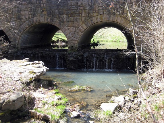 Rolling hills with open meadows, dense woods and spring fed streams. N 39.06697 W 92.94097 695 feet 45 degrees F. Nice, scenic hiking with a preserved pioneer village. [alpine-phototile-for-picasa-and-google-plus src=”user_album” uid=”117292386093793315084″ ualb=”5862402518364099265″ imgl=”fancybox” dltext=”Picasa” style=”floor” row=”4″ num=”50″ size=”220″ border=”1″ highlight=”1″ align=”center”...