 The Missouri River is the boundary between Kansas, Nebraska, Missouri, and Iowa so it is hard to tell just where you are. Today’s travels started in Kansas and ended in Nebraska, but state lines where crossed a couple different times. Even as I look out hte window, the scenery is so similar, it is difficult to tell which state you are in. It makes me realize that the boundaries are pretty much artificial and probably just a tool for government use. As today came near an end, I had a brief visit at a place that appears to be a real treasure for someone seeking a Lewis and Clark experience like I am. The place is the “Missouri River Basin Lewis & Clark Interpretive Trail and Visitor Center”. The Center is located in Nebraska City, Nebraska right on the West bank of hte Missouri River. I am staying at Nebraska City tonight and planning to spend most of tomorrow at the Center. Today’s data: Beginning odometer was 26,756 miles. Ending odometer is 26,929 miles. Bought fuel at Auburn, Nebraska, 13.374 gallons @ $3.499 for a total of $46.80 Meals cost $14.00 Lodging at Best Western for $77.57 + April 05,...
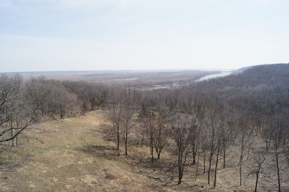
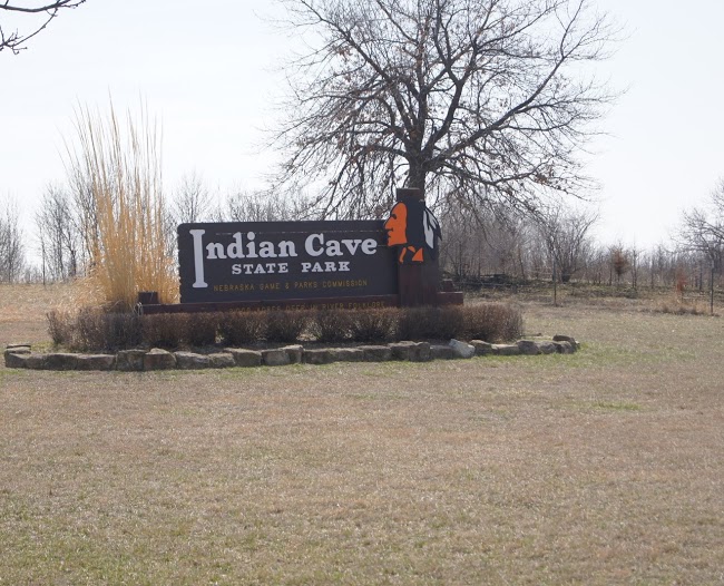 Beautiful park with a variety of attractions situated on the banks of the Missouri River. Beautiful vistas of the Missouri River are combined with gently rolling hills and limestone cliffs, all within a very well maintained state park. A tour of this park is worth far more than the $5 day pass. The unique one way paved roadway leads through some beautiful valleys of mature trees and meadows. An occasional peak at the river through the trees makes me think about the Natives observing Lewis and Clark as they struggled up the river. It would have been very easy to observe the Corps without being detected just a few feet from the water. The petroglyphs in the limestone are a real treasure to see. I can only imagine when and why the Natives would have devoted the time and effort to leave this artwork. [alpine-phototile-for-picasa-and-google-plus src=”user_album” uid=”117292386093793315084″ ualb=”5863513590416389201″ imgl=”fancybox” dltext=”Picasa” style=”floor” row=”4″ num=”75″ size=”220″ border=”1″ highlight=”1″ align=”center”...
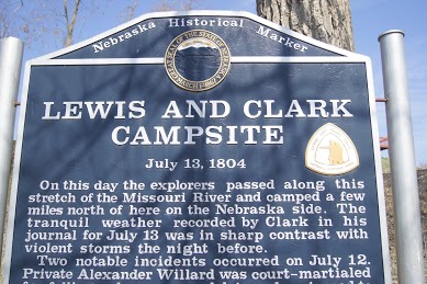 Lewis and Clarke Campsite. [alpine-phototile-for-picasa-and-google-plus src=”user_album” uid=”117292386093793315084″ ualb=”5863507615165308257″ imgl=”fancybox” dltext=”Picasa” style=”floor” row=”4″ num=”75″ size=”220″ border=”1″ highlight=”1″ align=”center”...
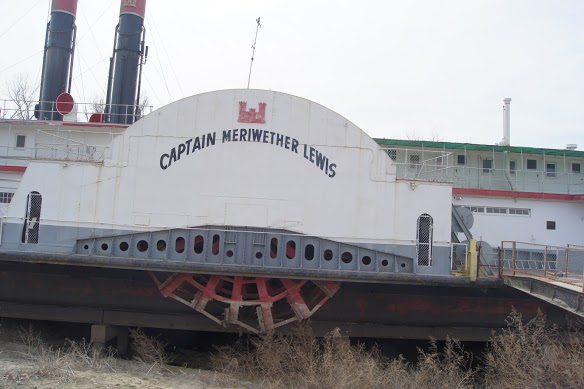 Captain Meriwether Lewis paddle wheeler weathering on the banks of the Missouri River. On the West bank of the Missouri River at Brownville, Nebraska there sits an old paddlewheeler dredge ship. It is safely situated on a “dry dock” It was very interesting to see the huge paddle wheels on each side and the gigantic dredging equipment on the bow. Markings indicate the ship is owned by the U.S. Army Corps of Engineers. [alpine-phototile-for-picasa-and-google-plus src=”user_album” uid=”117292386093793315084″ ualb=”5863519250135337249″ imgl=”fancybox” dltext=”Picasa” style=”floor” row=”4″ num=”75″ size=”220″ border=”1″ highlight=”1″ align=”center”...
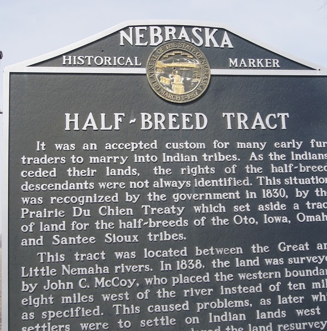 Half-breed sounds like a derogatory term, but it describes a common situation in our history with the Native Americans. This is a roadside marker that caught my attention, both by the unusual term and that it is a part of our history. The sign is on US 136 in Eastern Nebraska. N40.39275 W95.82182 Elevation 925 feet [alpine-phototile-for-picasa-and-google-plus src=”user_album” uid=”117292386093793315084″ ualb=”5863521214659697089″ imgl=”fancybox” dltext=”Picasa” style=”floor” row=”4″ num=”75″ size=”220″ border=”1″ highlight=”1″ align=”center”...